


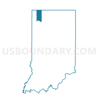
WESTCHESTER 09, Porter County, Indiana
About
Outline

Summary
| Unique Area Identifier | 580115 |
| Name | WESTCHESTER 09 |
| County | Porter County |
| State | Indiana |
| Area (square miles) | 3.91 |
| Land Area (square miles) | 3.91 |
| Water Area (square miles) | 0.00 |
| % of Land Area | 100.00 |
| % of Water Area | 0.00 |
| Latitude of the Internal Point | 41.62321490 |
| Longtitude of the Internal Point | -87.02132560 |
Maps


Graphs
Select a template below for downloading or customizing gragh for WESTCHESTER 09, Porter County, Indiana


Neighbors
Neighoring Voting District (by Name) Neighboring Voting District on the Map
- JACKSON 01, Porter County, IN
- PINE 01, Porter County, IN
- PINE 02, Porter County, IN
- WESTCHESTER 02, Porter County, IN
- WESTCHESTER 08, Porter County, IN
- WESTCHESTER 14, Porter County, IN
Top 10 Neighboring County Subdivision (by Population) Neighboring County Subdivision on the Map
- Westchester township, Porter County, IN (19,396)
- Jackson township, Porter County, IN (5,328)
- Pine township, Porter County, IN (2,709)